The radar (Radio Detection And Ranging) technique uses the interval of electromagnetic waves' wavelength (100 m - 2.7 mm) and
frequencies (3MHz - 110 GHz). Difference of scale of 4-5 relative to light provide a remote sensing tool, and its signs are
not scattered on cloud or fog. The radar is an active sensor, which means, it also performs the 'illumination" of the area itself.
It can be mentioned Zoltán Bay, who developed a radar tool and remotely sensed the moon with that (1946).
The radar is sensing and detecting time, amplitude and phase of the reflected signals from surface and surface objects at source.
Radar beam illuminate a wide area. From moving airplane or satellite, the same surface point is being illuminated many times.
Redundancies and measurement surplus of radar signs give the possibility of using Synthetic Aperture Radar (SAR) technique.
Afterward the important data can be retrieve by post-processing which can only be possible physically measured by flying a very large
directional antenna. The configuration of SAR sensors basically depend on three parameters: wavelength,
incidence angle and polarization. These parameters affect the interaction of surface and microwave, which influence the reflected
intensity and scattering mechanism.

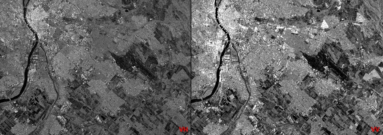
Different polarization of radar around Budapet (left: VH polarization, right: VV polarization)
The polarimetry area is based on determination, process and analysis of polarization of electromagnetic waves.
This measured information is about the geometric structure, reflexivity, shape, direction, geophysical properties with the
reflected waves from the surface objects.
This technique is suitable for surface roughness, slope of the surface, moisture content of the soil, biomass, height of vegetation,
variety of trees or even monitoring of snow, determination of is thickness with the measure of amplitude, ratio of amplitudes,
relative phase angle, polarimetric coherence of reflected signals.
Main areas of using are land cover monitoring, agriculture (crop yield estimation, water content estimation, smart farming,
mapping agricultural damages), forestry (biomass estimation, leaves changes, plant height estimation, deforestation monitoring),
oceanography (ship detection, oil spill monitoring), topography, precise digital elevation model (DEM).

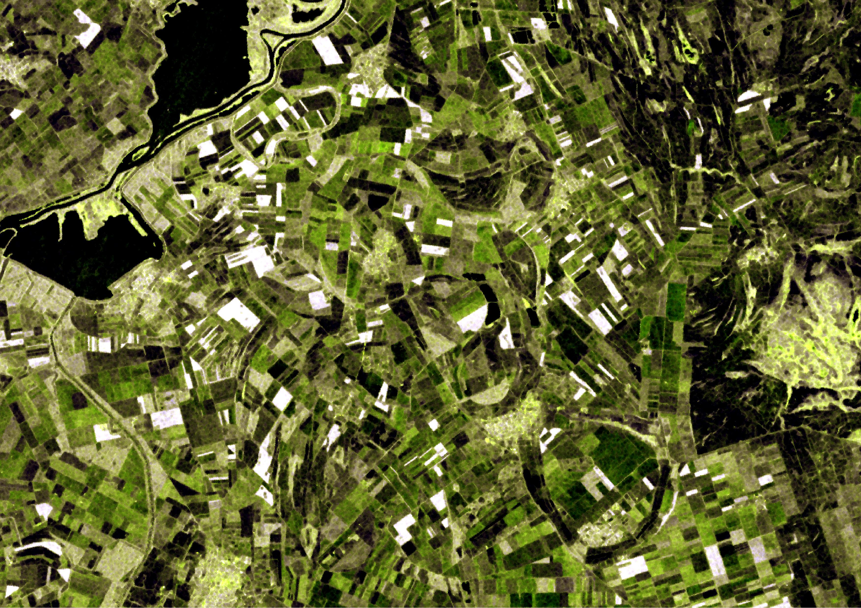
2017.05.21. Flowering of rapeseed (white parcels) around Tisza-Lake

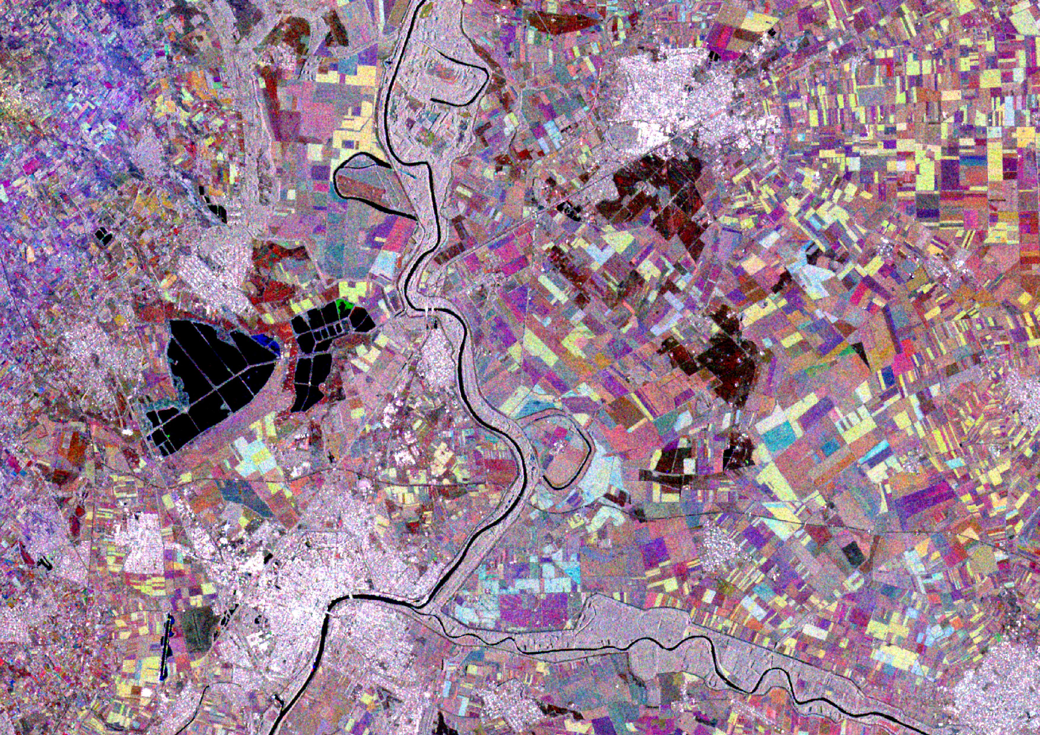
Multitemporal radar composit around Szeged

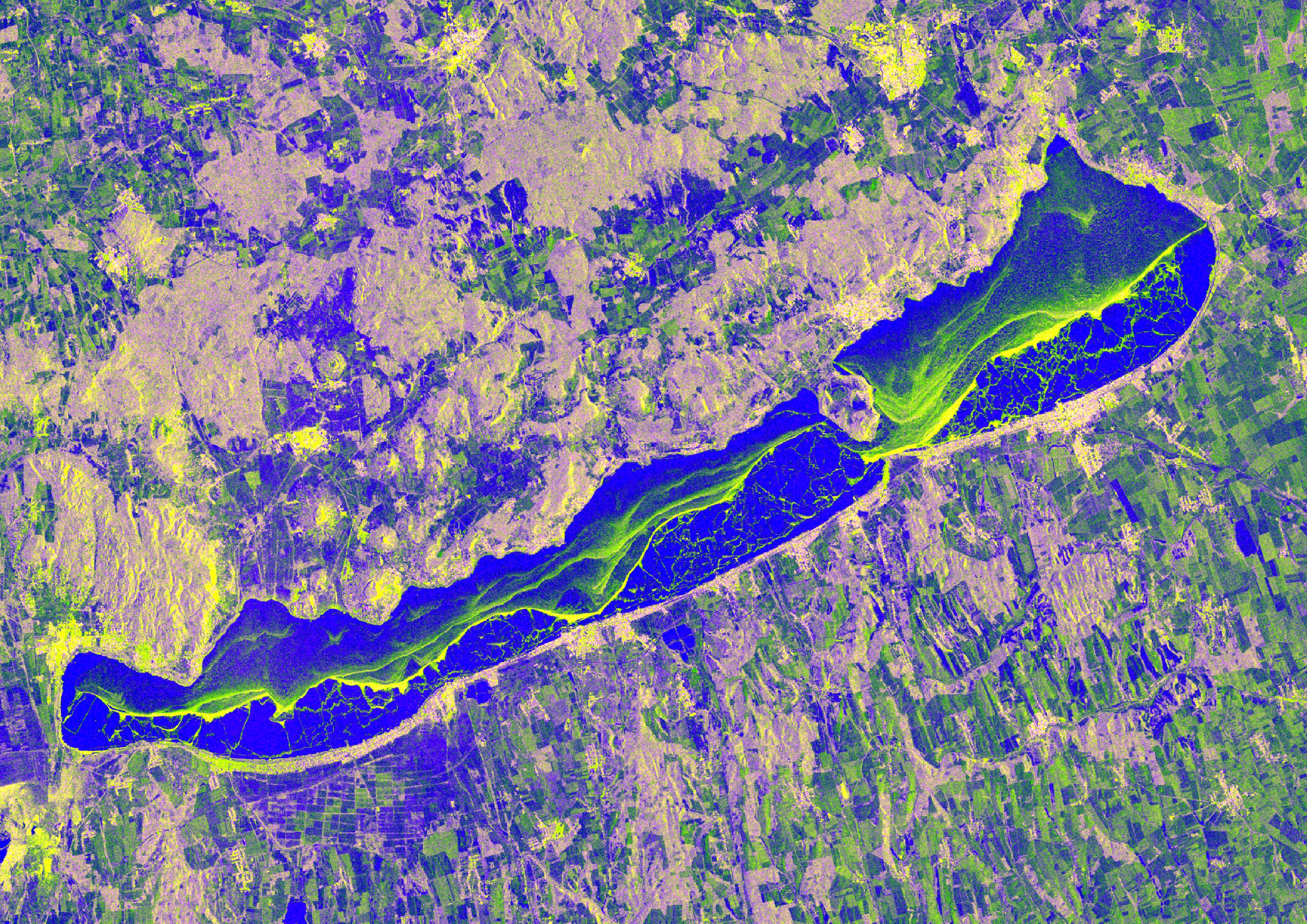
2017.01.07. Radar composit about the frozen Balaton
The radar is sensing and detecting time, amplitude and phase of the reflected signals from surface and surface objects at source. Radar beam illuminate a wide area. From moving airplane or satellite, the same surface point is being illuminated many times. Redundancies and measurement surplus of radar signs give the possibility of using Synthetic Aperture Radar (SAR) technique. Afterward the important data can be retrieve by post-processing which can only be possible physically measured by flying a very large directional antenna. The configuration of SAR sensors basically depend on three parameters: wavelength, incidence angle and polarization. These parameters affect the interaction of surface and microwave, which influence the reflected intensity and scattering mechanism.

This technique is suitable for surface roughness, slope of the surface, moisture content of the soil, biomass, height of vegetation, variety of trees or even monitoring of snow, determination of is thickness with the measure of amplitude, ratio of amplitudes, relative phase angle, polarimetric coherence of reflected signals.
Main areas of using are land cover monitoring, agriculture (crop yield estimation, water content estimation, smart farming, mapping agricultural damages), forestry (biomass estimation, leaves changes, plant height estimation, deforestation monitoring), oceanography (ship detection, oil spill monitoring), topography, precise digital elevation model (DEM).


