Vlf wave propagation
Satellite remote sensing
Sun-Earth Physical relations
River dynamics
Geoinformatics
The Research Group deals with the theory and practics of geocoding
of different spatial data sources. The estimated and defined parameters give
the characteristics of-
the geodetic datums, and
-
the map projections and projection systems.
Defining the datums, the parameters of the shift - and sometimes the rotation - of
the ellipsoids and the WGS84 Earth centered ellipsoid are given, via the three-dimensional
Helmert transformation.
Concerning the projection analysis, the most frequent problem is that the definition
of the chosen projection is too difficult: the widespread used GIS packages or the
GPS receivers don’t know it, not even its type. In this case, the analysed projection
can be substituted by a standard one, resulting similar (slightly differing) coordinates.
An example: the Hungarian EOV contains a double projection (from the ellipsoid
to the sphere, then from the sphere to the cylinder). This type is unknown in the
GIS packages so it should be substituted by a direct (ellipsoid to cylinder),
standard oblique Mercator projection. The difference between the resulted and
the genuine EOV coordinates don’t reach the 0.2 millimeters!
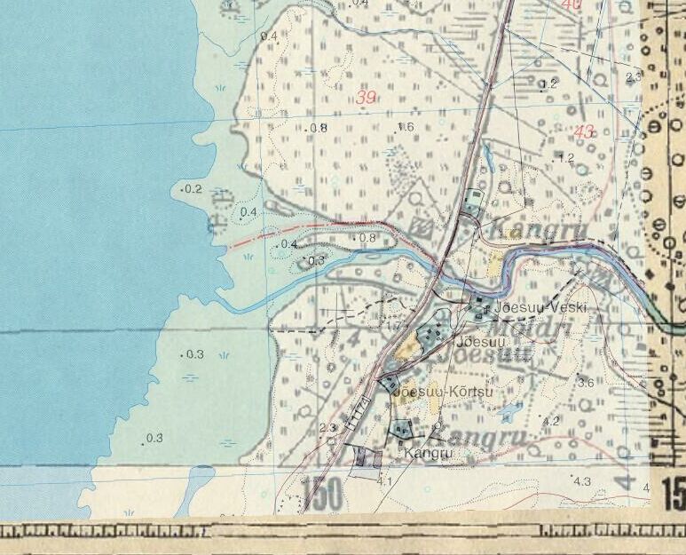
Using the correct datums and projections it is possible to fit the maps of
different systems, sometimes with substantial time difference, without seeking
’similar points’ for geocoding. The above image shows an example: the 1936 and
1992 survey sheets of Estonia are fitted together, using only the geodetic and cartographic
reference and the grid lines.
Hungarian Datum 1972 Page
The Official Majster Page
Cooperations:
 University of Tartu, Institute of Geography, Estonia
University of Tübingen, Institut für Geowissenschaften, Germany
Tisza River Project
ARCDATA a.s. Praha, Czech Republic
Space Geodetic Observatory, Institute of Geodesy, Cartography and Remote Sensing, Penc, Hungary
graphIT Ltd., Budapest, Hungary